Central Virginia Supercell Structure-Fest 
June 25, 2020
Photos by Peter Forister and Andrew Shearer
June 2020 was a remarkable month for storms in Virginia! After a very slow start to the spring storm season, the summer pattern of high instability and marginally active shear kicked in with the following results. 


The SPC started the day by putting most of Virginia in a marginal risk for severe thunderstorms, noting moderate ML CAPE and widespread shear of 45-50kts. Morning soundings from across the region observed a mid level cap which suggested that most storms would not become immediately robust, and threw in uncertainty about the overall coverage of storms. 
A mesoscale discussion at 12:30pm from the SPC noted that the thermodynamic environment was limited (1500 MLCAPE), but that a few marginal supercell structures could be expected with any orographically induced convection. 

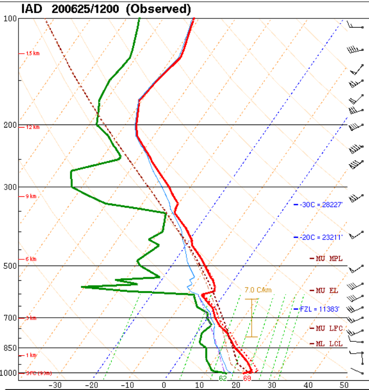
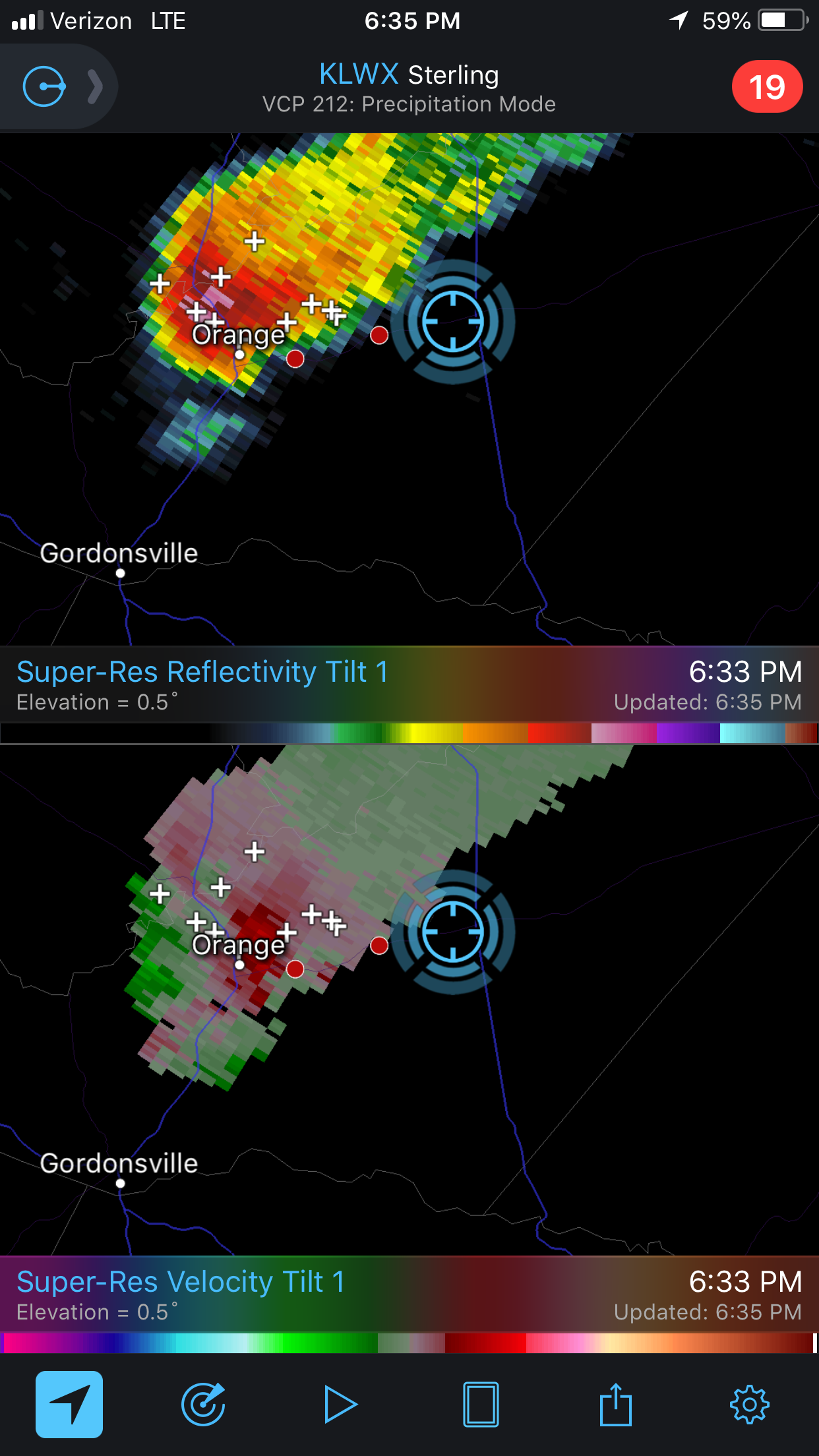
12z sounding from Sterling, VA. Note the strong temperature inversion (cap) at 600mb

With this relatively dismal outlook, we didn't expect much to happen. An early line of convection rolled through Central Virginia around 11am-1pm, stabilizing the air behind it. Radar indicated a second batch of storms developing over the high terrain of West Virginia about the same time, but models were extremely inconsistent about whether those storms would survive far enough east or not. 
A single persistent updraft managed to survive to Harrisonburg at 4pm. It didn't look like much on live views (h/t to @WHSVaubs on Twitter), but storms coming from this direction have often become "interesting" once they cross the Blue Ridge. 
With previous experiences in mind and based on a gut feeling, we (Peter and Drew) met in Ruckersville an hour later to wait for the cell to approach. 
At about 6pm the cell crossed the Blue Ridge and made it to Rt. 29 a few miles north of Ruckersville. Although unimpressive on radar, the storm maintained a crisp updraft base and echo tops of about 30,000 ft.

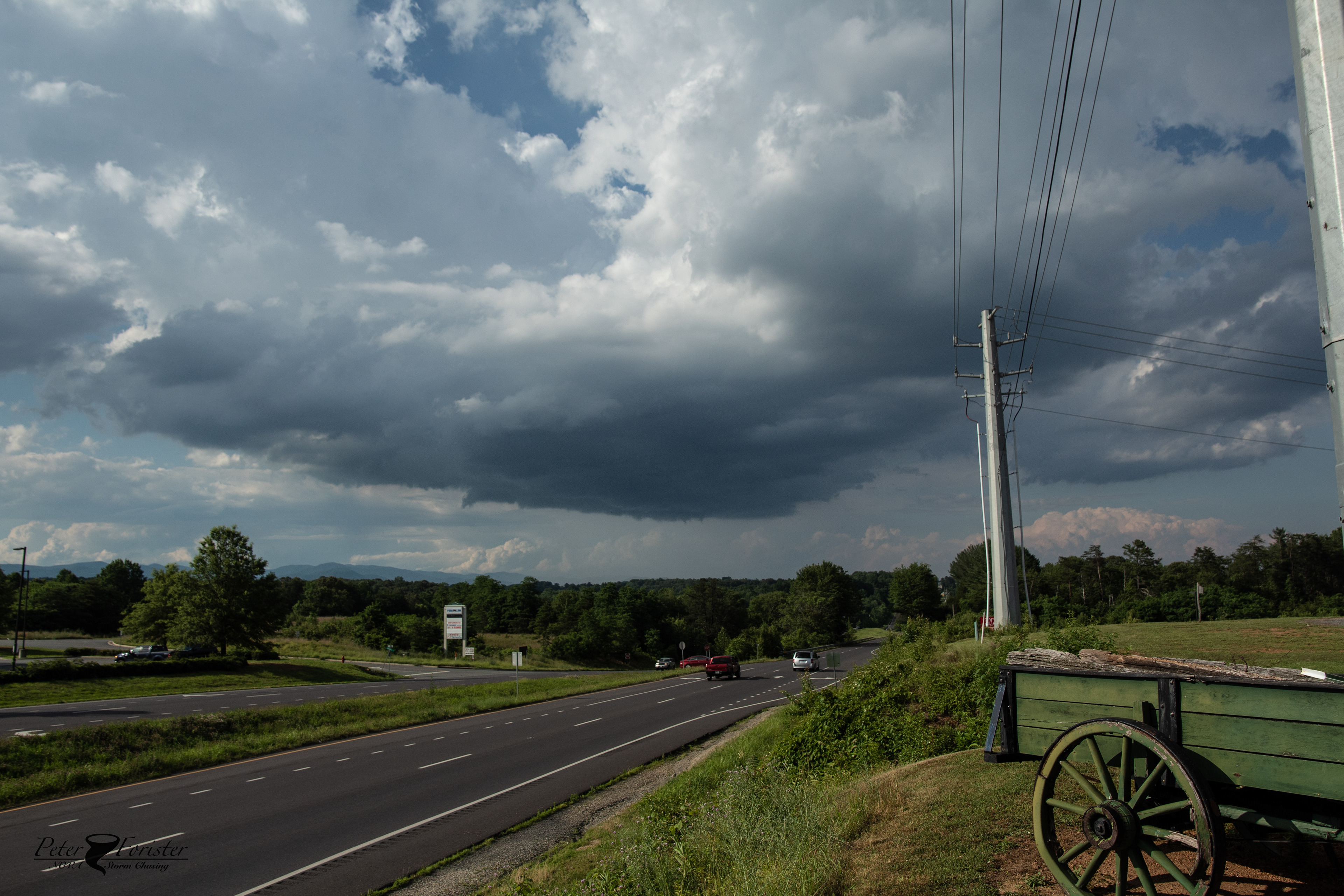
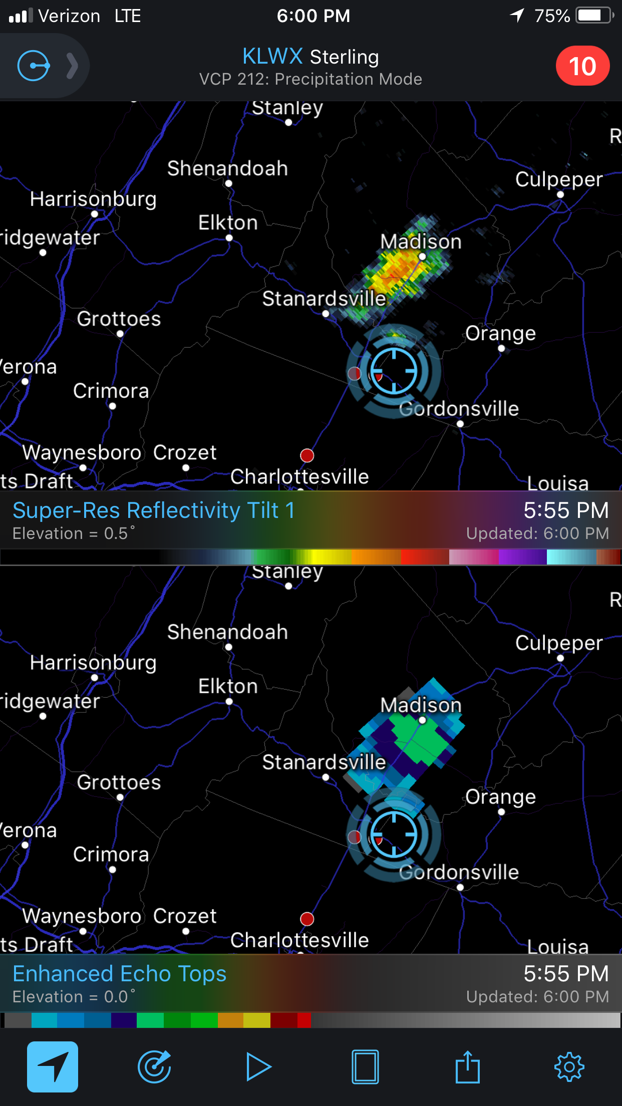
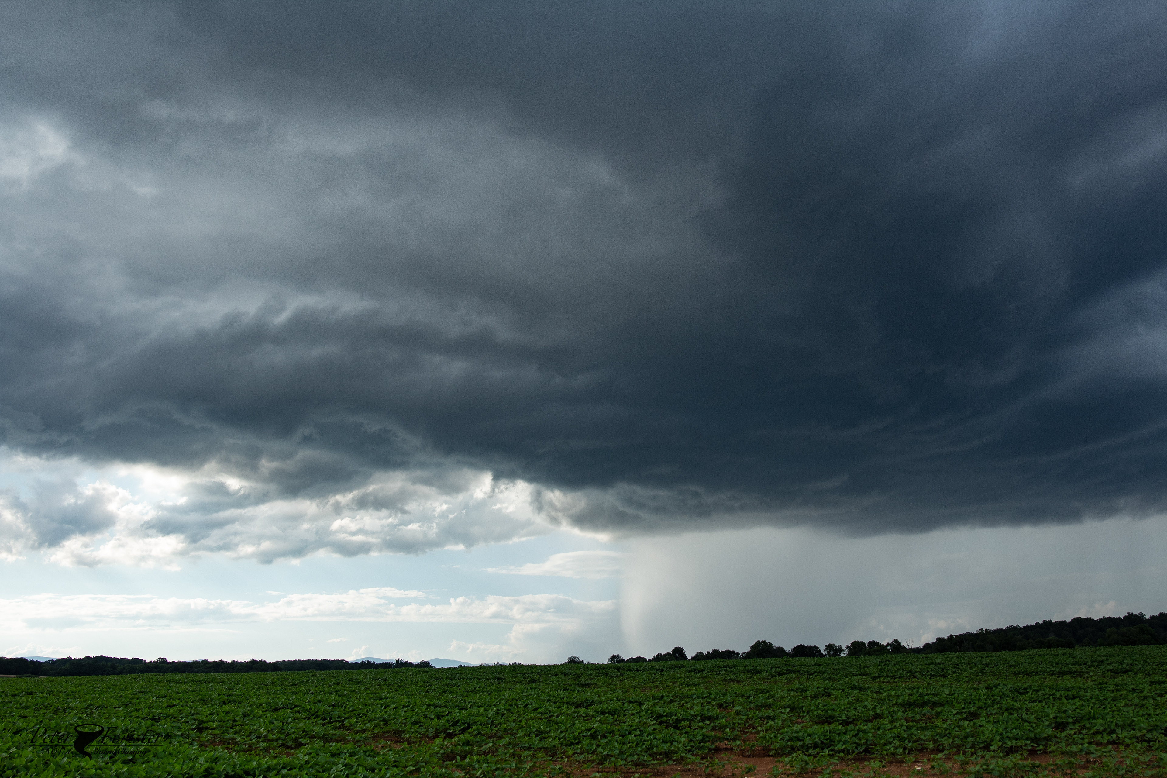
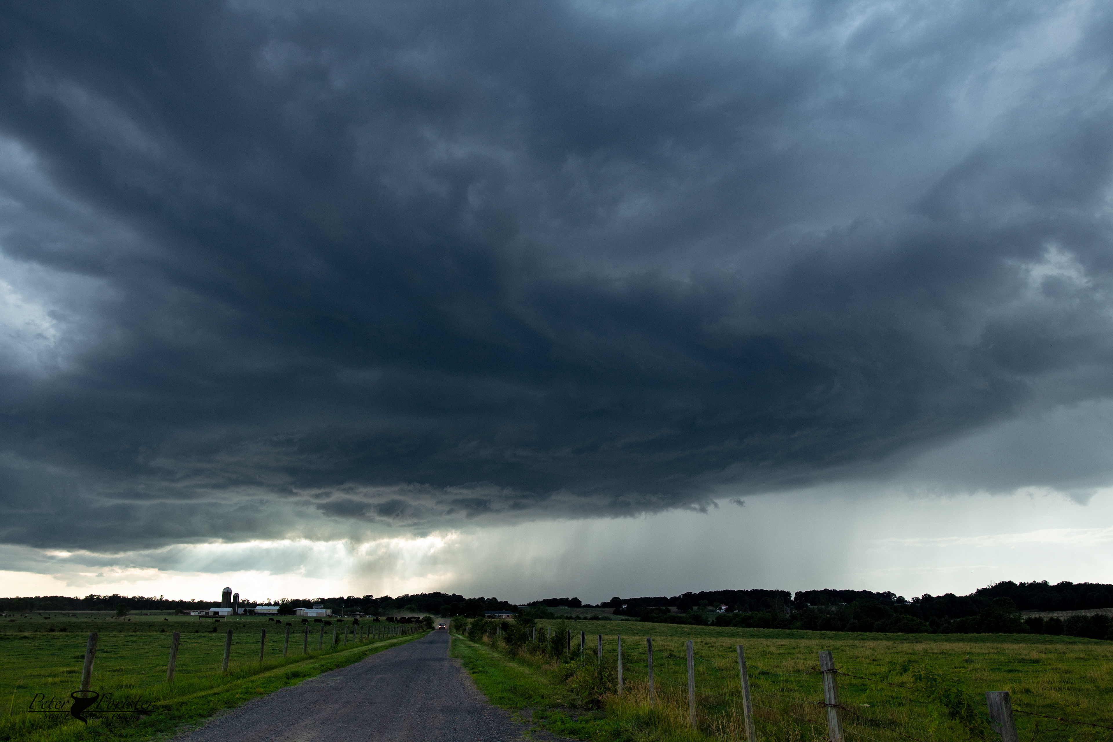
The updraft as viewed from Ruckersville looking north. Photo same time as radar grab just before 6pm. 

The storm took a slight right turn at this point from due easterly motion to ESE motion, taking the core of the storm towards Orange. We set out going east to keep up with it.

It was at this point (6:10-6:15) when the cell finally reached the more robust thermodynamic environment that existed in Central VA. We estimate that ML CAPE was around 1500, as noted by the SPC. However, SBCAPE was probably much higher (around 2500), so as the storm started intensifying and the LCLs lowered, it had more fuel to use. All of these elements kicked in at nearly the same moment, leading to rapid intensification of the updraft after 6:15. 

The combo of intense updraft and 50kts of shear allowed the cell to start rotating. Our next view of the storm showed us some supercell characteristics, including an RFD cut and high-based wall cloud.

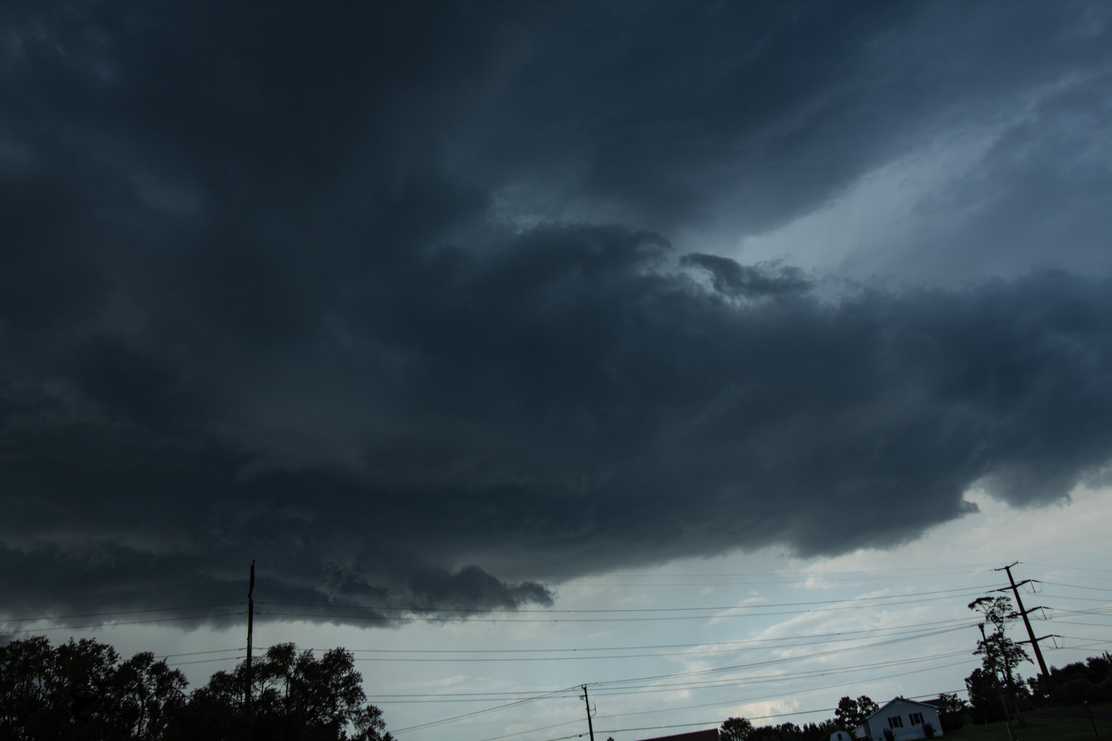
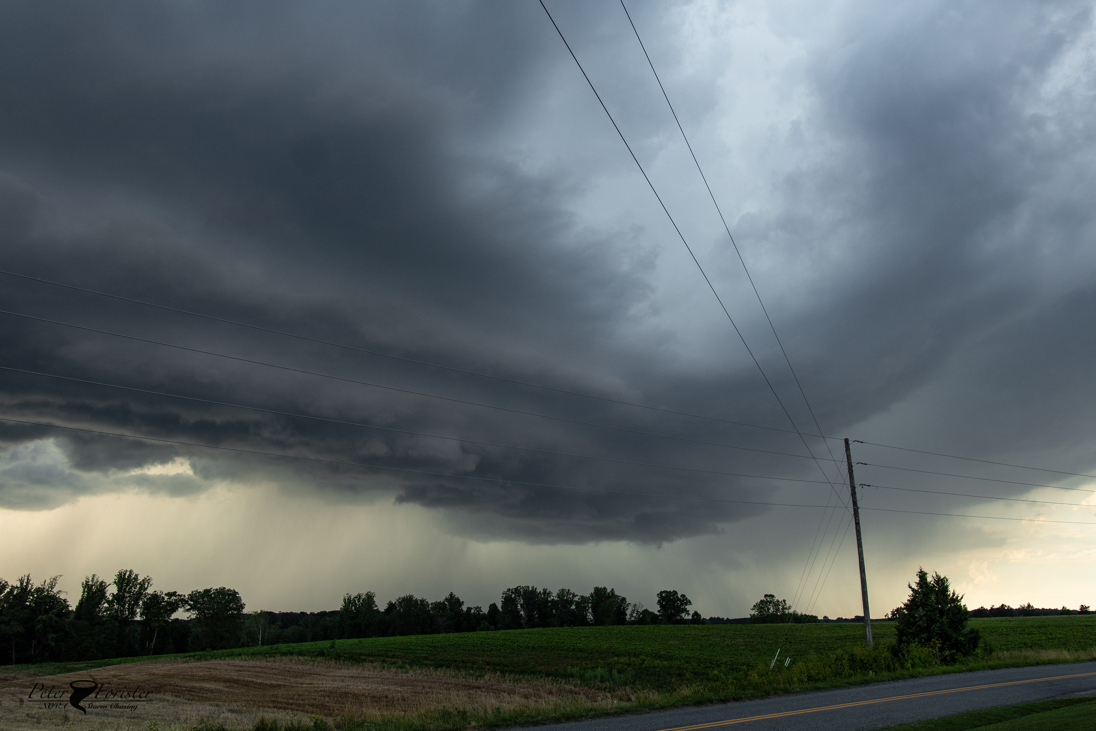
Mesocyclone striations developing, and an RFD cut visible. 

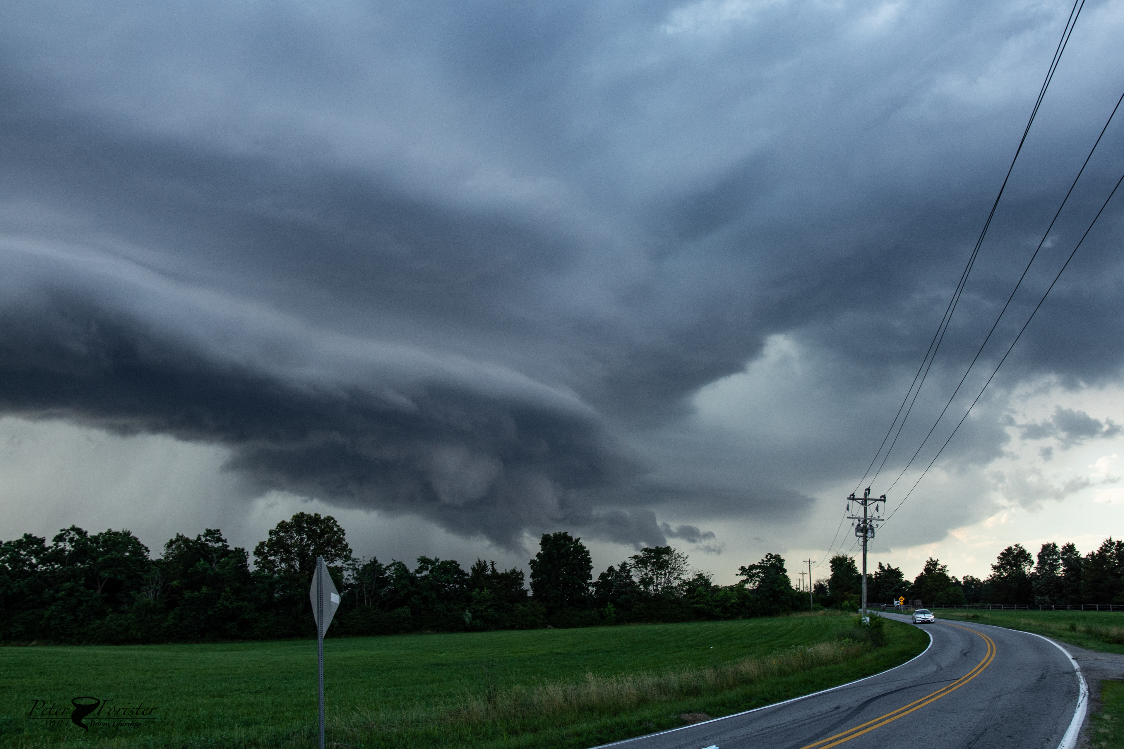
Small wall cloud on the far side of the RFD. Hail core also visible in the background. 

Lightning from the storm's updraft had a notable uptick at this point. Clear-air bolts started falling around us - probably indicating the formation of ice as the storm grew increasingly taller. 

We continued through the town of Orange and then stopped by the airport (on the east side of town) for another look at the intensifying cell. At this point an updraft "vault" had developed, allowing us to look straight up the main updraft. It was also about this time (6:30-6:40) that the first wind damage reports were recorded. A microbusrt fell out of the main updraft and produced winds over 60mph in Orange. 

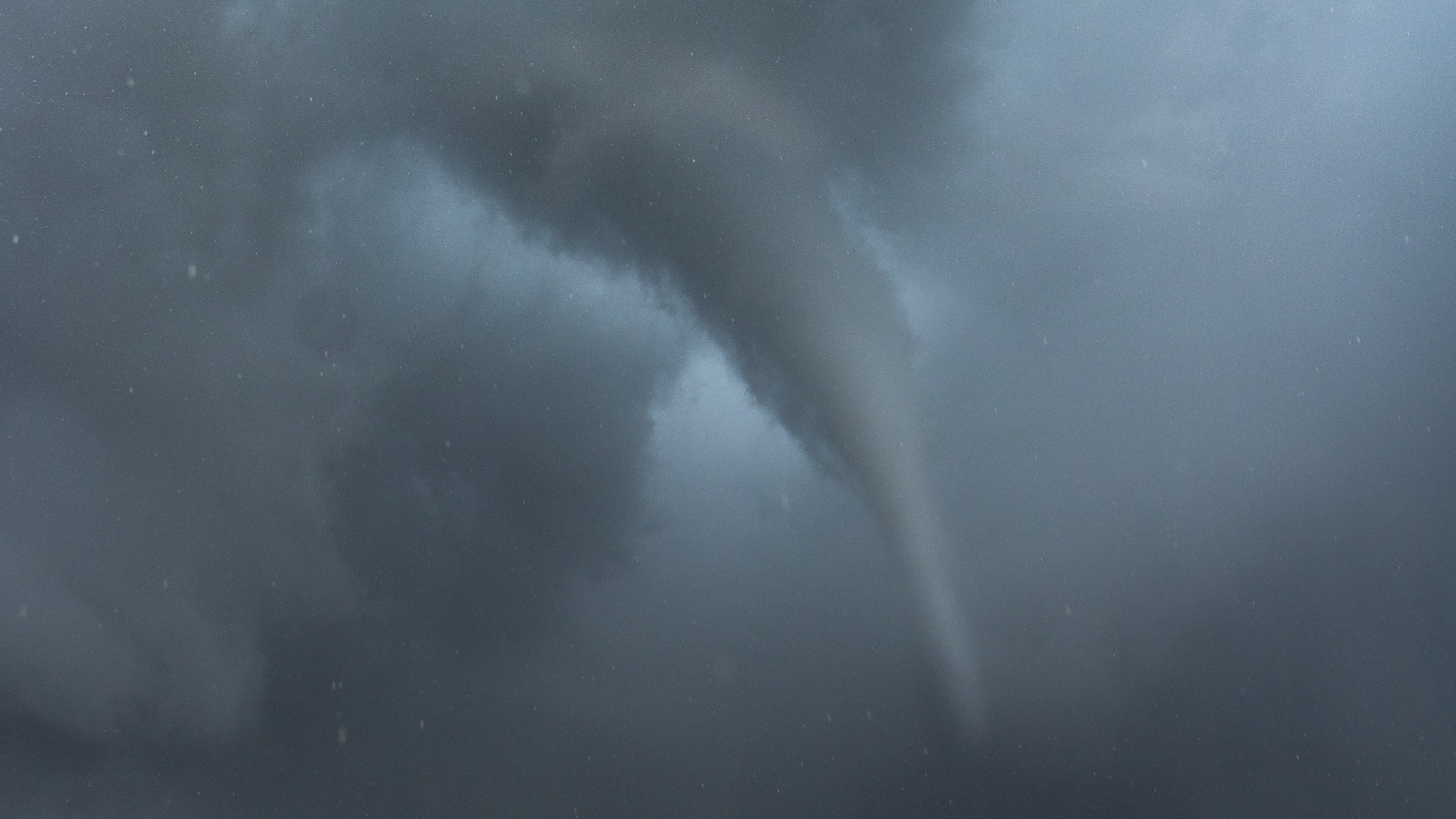
The view of the inflow band and updraft vault. Looking nearly straight up in Orange at 6:30.

Microburst/rain foot as viewed from the Orange airport. 

At this point we were on Rt. 20 which continues to the ENE, away from where the storm was travelling. We made the move to get out to Rt. 522 and dropped south into poorer terrain. This choice would eventually take us in the direction of Lake Anna and dense forests, but offered the best chance to stay southeast of the main updraft. After another 15 minutes of driving without a view we found a field south of Unionville. 

This is where the supercell structure really started to pick up. Our theory is that the cold pool influence from the microburst over Orange pushed outflow underneath the updraft. This mechanism would usually kill storms, but in this case with the high shear, the updraft actually managed to intensify by wrapping in its own outflow boundary. A very unique process that was interesting to watch in person!

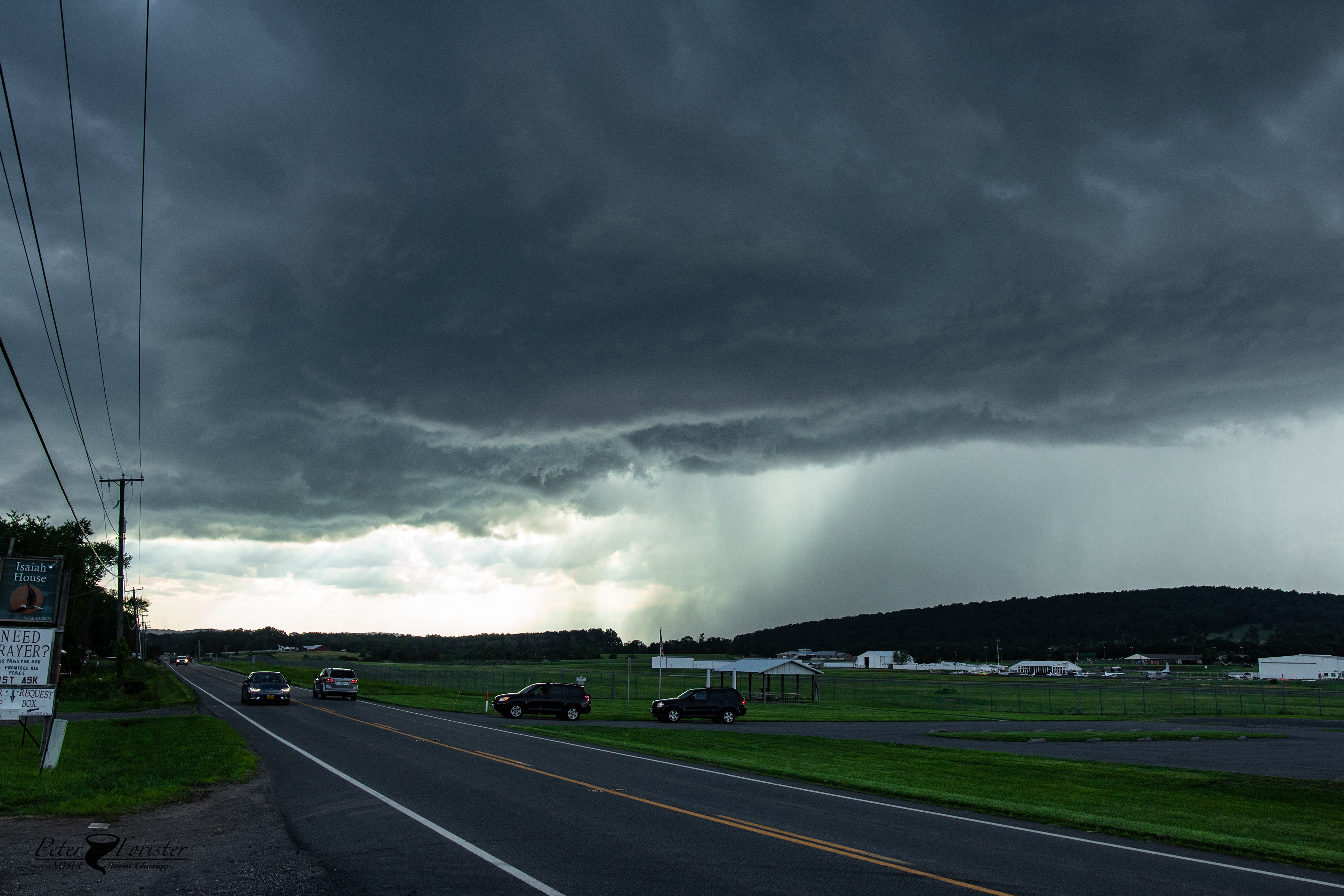
The supercell as viewed from south of Unionville. 6:45

Because of the outflow/cold pool influence, the southern flank of the storm took on a shelf cloud appearance. Multiple stacks! We continued SSE along the north side of Lake Anna as this structure continued to improve. 

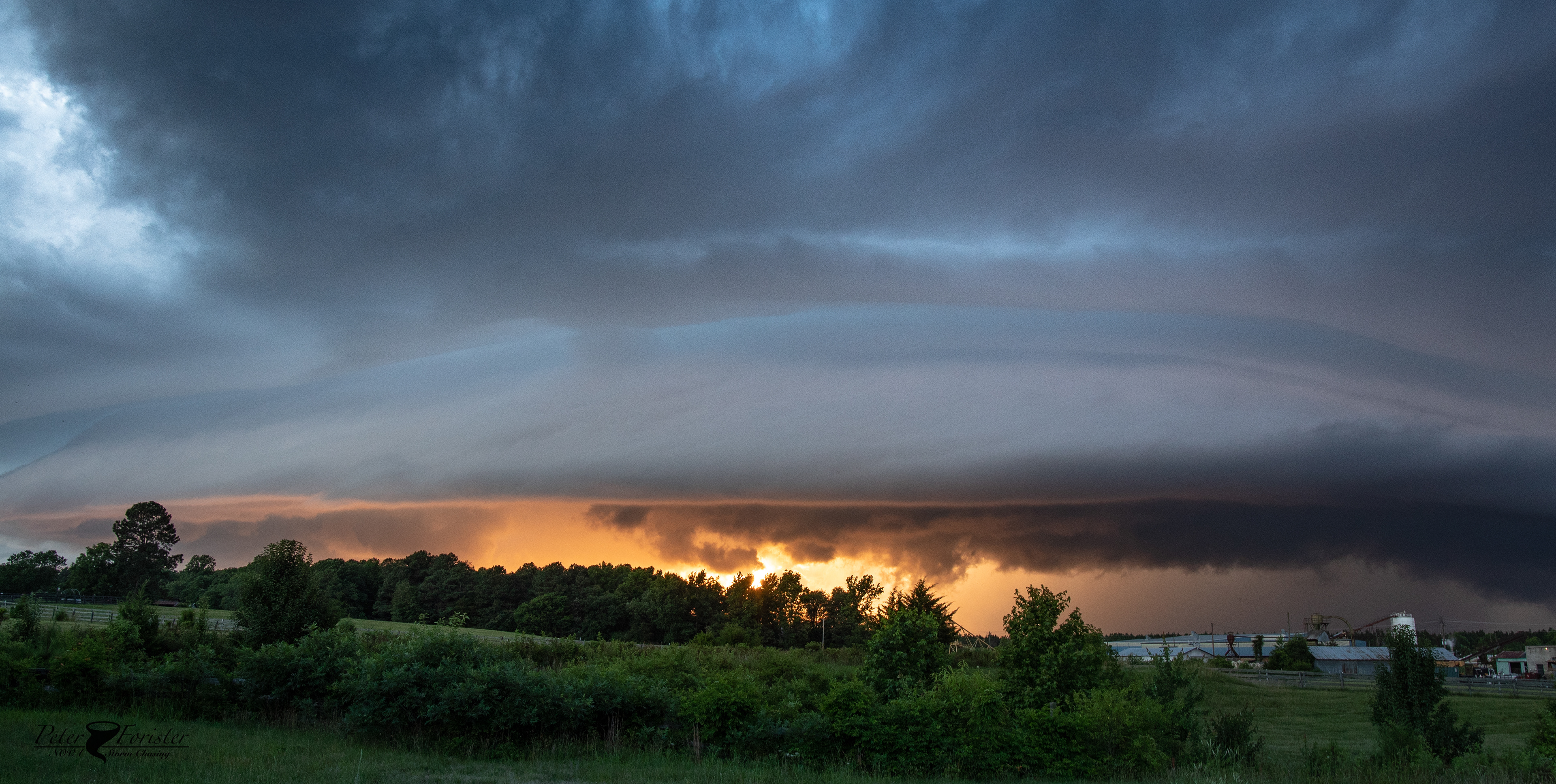
RFD shelf. Random field north of Lake Anna approx. 7:00pm

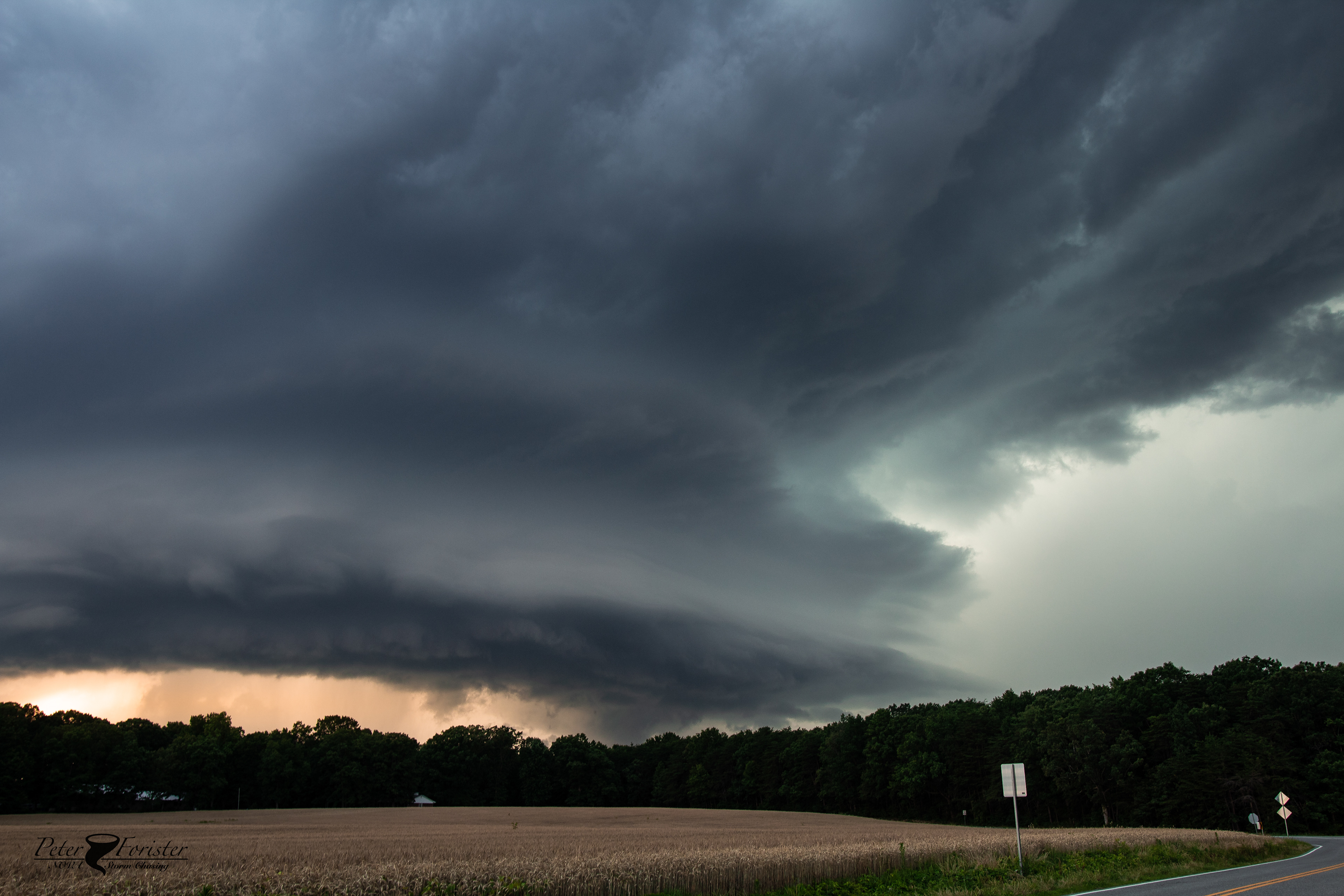
The shelf cloud continued to improve. Approx. 7:15pm

After about 7:15, the storm underwent yet another transition. The updraft, although it had survived the outflow undercut, was looking sort of small. This changed very rapidly as the rotating updraft got a second breath of intensification. 
What followed from 7:15 to about 7:45 was some of the best structure we've seen in Virginia. The supercell developed an obvious hook echo, and storm reports said that the core was producing ping-pong ball sized hail and damaging winds. We stayed out of the core and had multiple viewings of the storm in fields north and northeast of Lake Anna. 

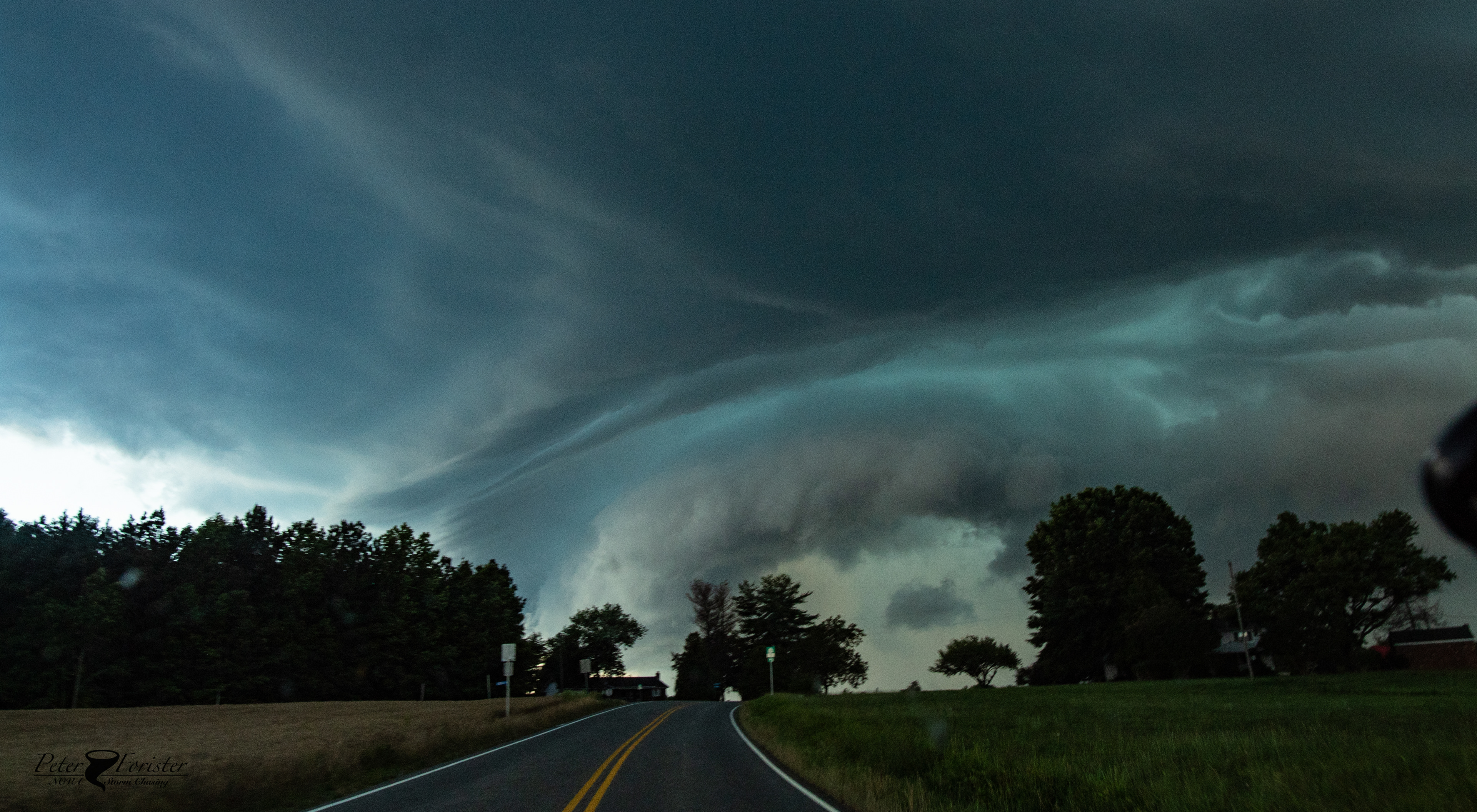
Note the more vertical stack and crisp edges as compared to before. This was an indication of re-intensification. There is also probably a low wall cloud there in the center of the frame. 

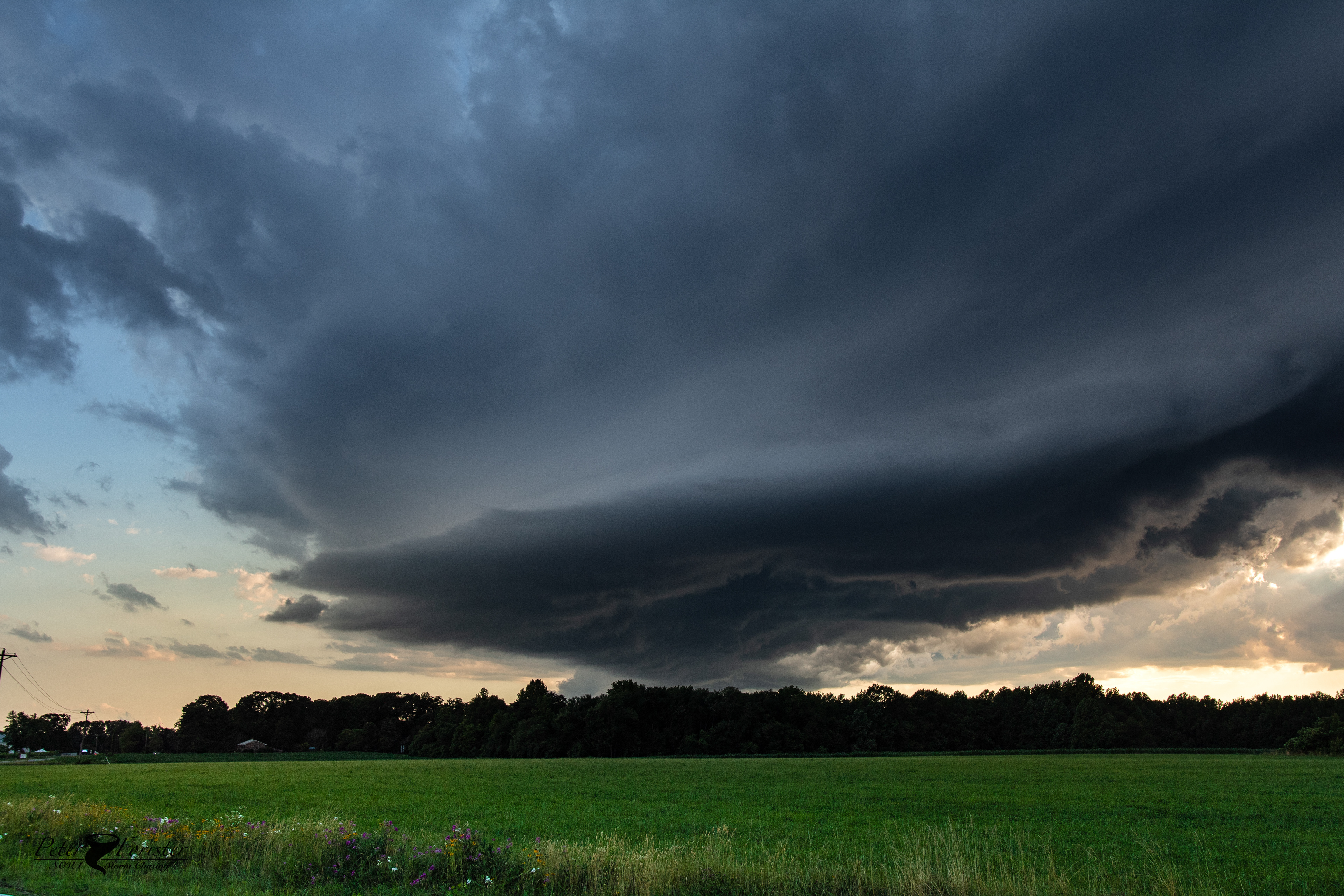
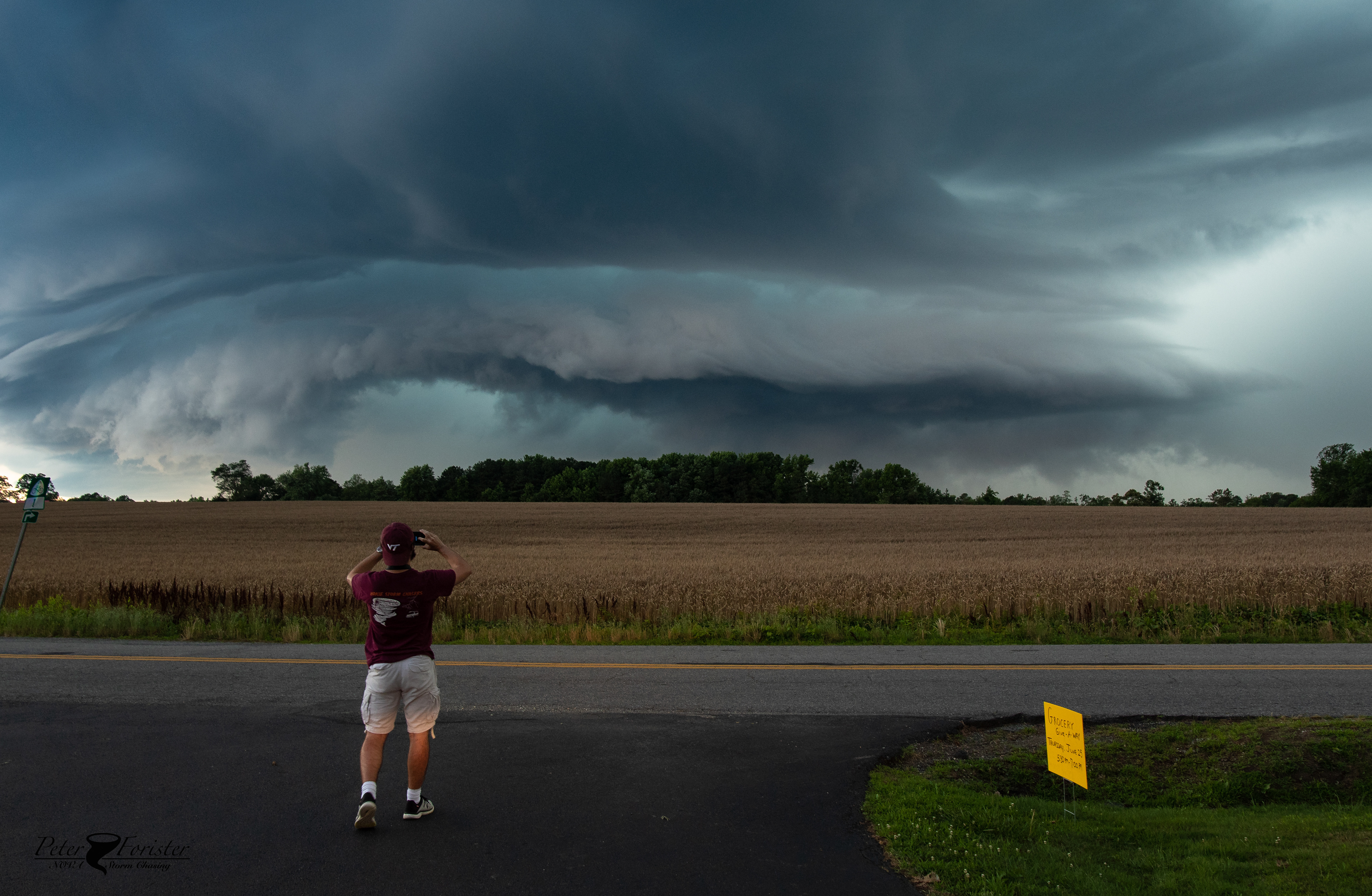
Genuinely stunning structure. 7:30 pm

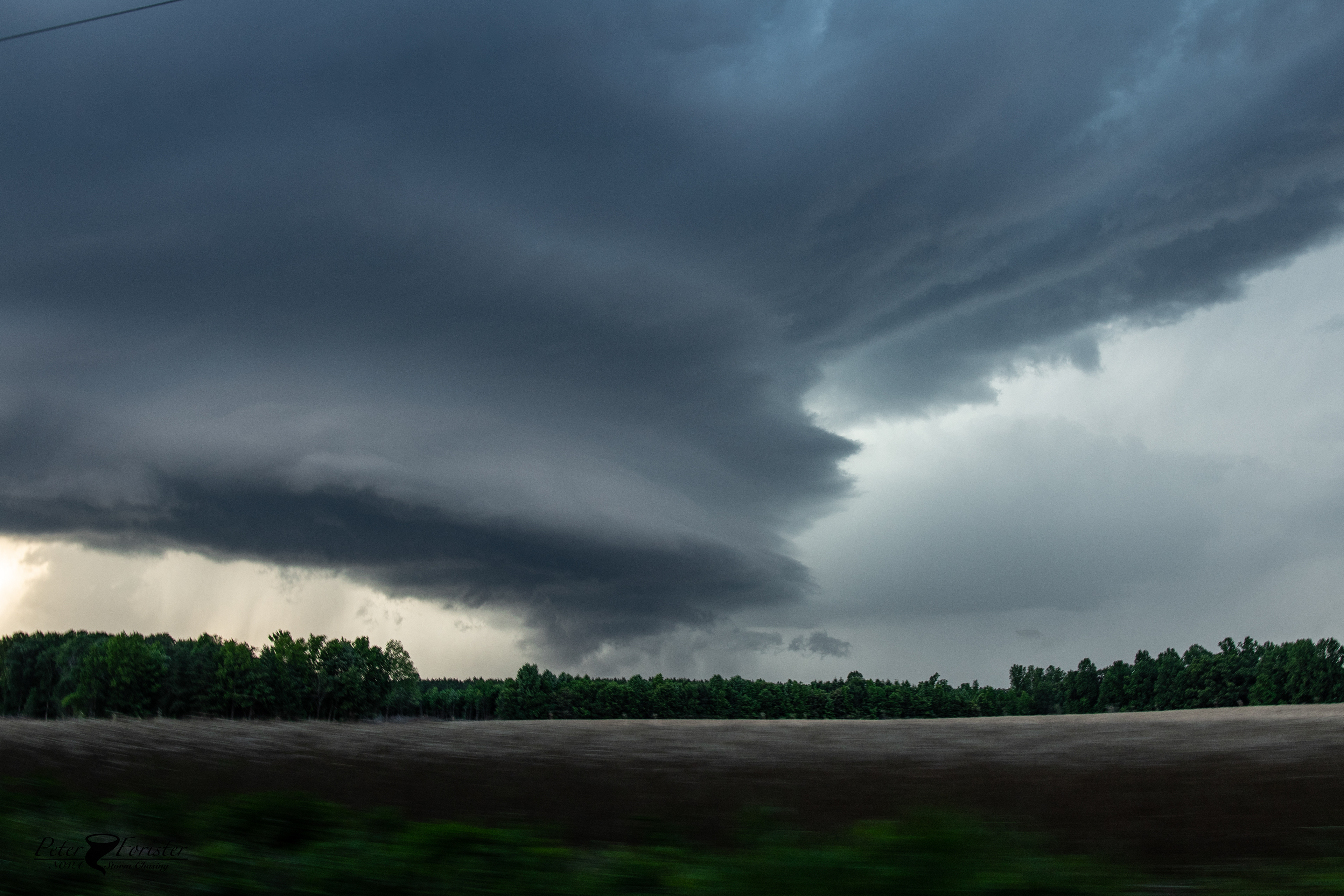
A shot snagged through the windshield as we left a viewing field. Giant mesocyclone closing in!

After this half-hour or so of stunning updraft structure, the storm began transitioning back to primarily outflow dominant. The structure continued, but looked more and more exclusively like a shelf cloud. We drove all the way east to I-95 near Lake Caroline, and watched it from fields along Rt. 1. 

As the core of the storm approached Rt. 1, the sun set behind the storm illuminating the precipitation and back-lighting the shelf cloud. 

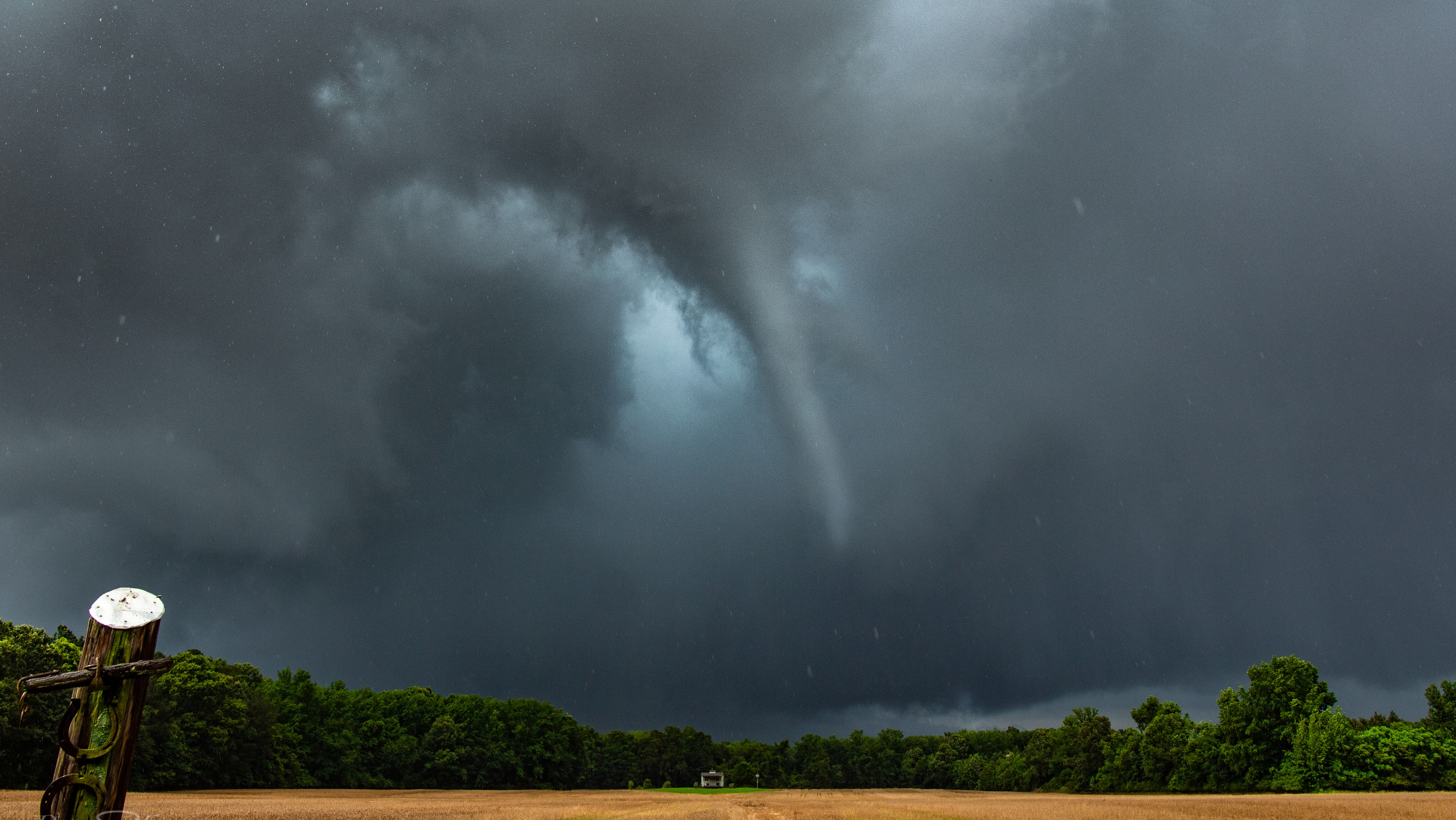
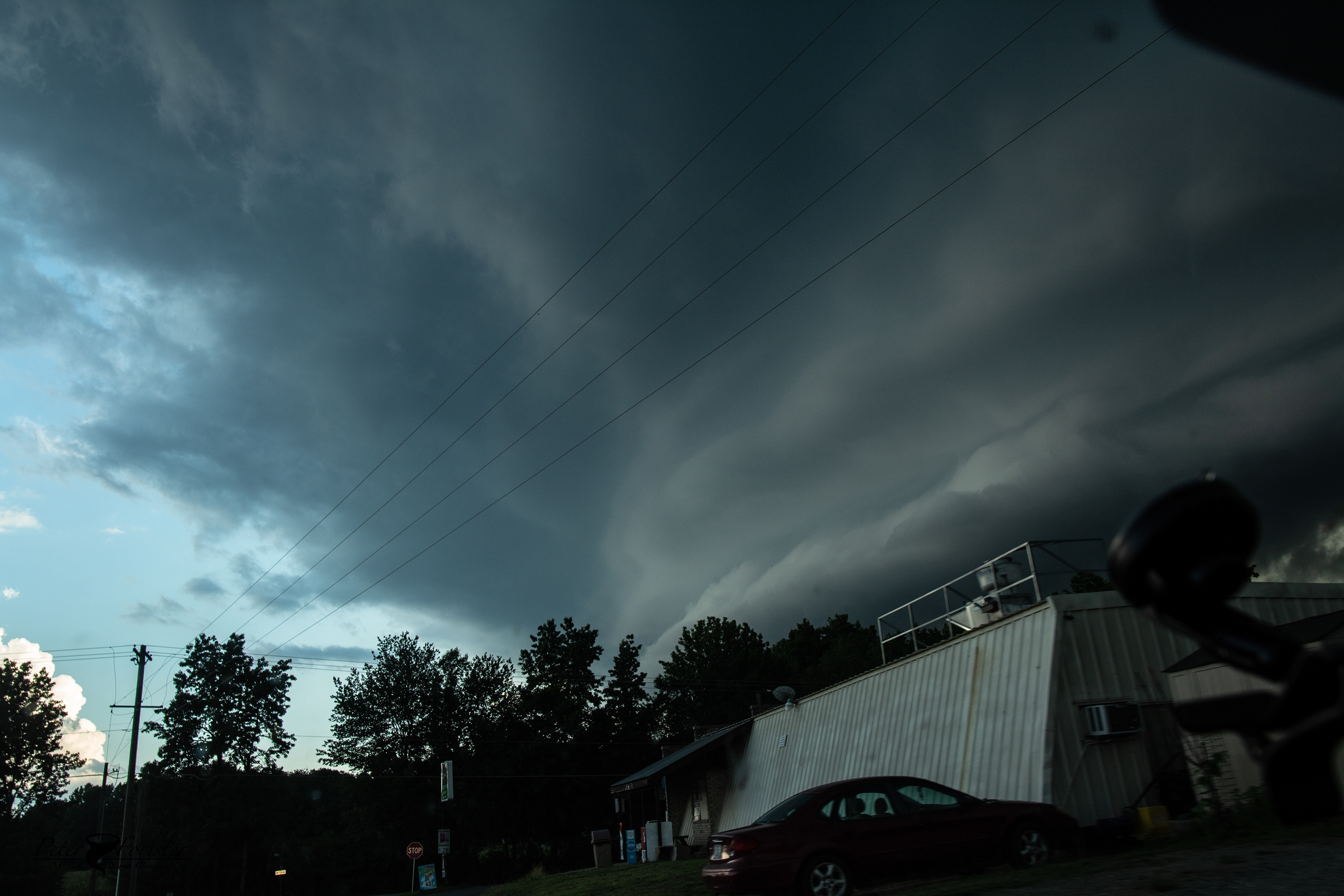
Scary-looking shelf cloud. Looking straight into the hook

With this view we decided to call it a day. We didn't feel like chasing the jungles east of I-95 and with the loss of sunlight, photographs would have been very difficult. We drove back to where the core crossed the highway, but only found marginal branch damage and no hail. The storm probably peaked in intensity a few miles west of 95. 

You may also like

Back to Top